|
Fenham
Sat. 2nd Sep., 2000 |
 |
|
|
One of the largest sections of the city, Fenham is west of the centre and extends to the north of West Road.The area is
named from the old English words for village on a flat area subject to lying water or flooding. I can't think that there could be much flooding as the district contains the highest point in the city! The
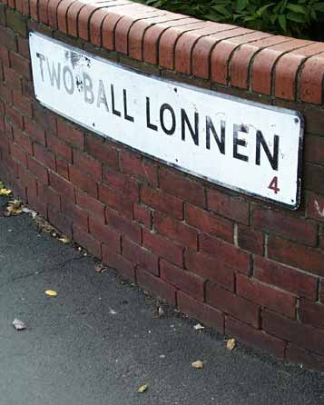
land adjacent to what is now the Town Moor may well have been badly drained before the present housing was built from the latter part of the 19th century. Two Ball Lonnen was an ancient lane (Lonnen)
predating the construction of West Road in the mid 1700s. |
|
|
|
|
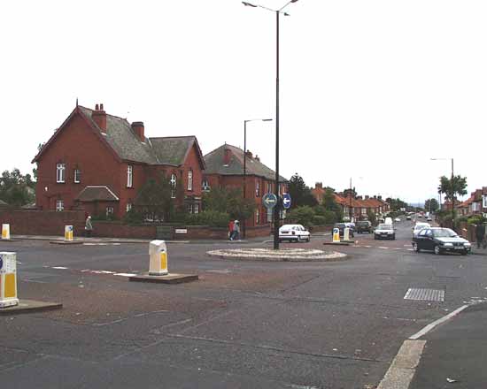
Here, at the junction of Two Ball Lonnen, straight ahead, Cedar Road, left, and Lanecrost Drive, right, some of the original Edwardian
housing stands on the corner. Later 1930s housing extends south to the junction of West Road in the distance. |
|
|
The Fox and Hounds lies just west of the junction of West Road and Two Ball Lonnen. The West Turnpike was built in 1751 to enable General
Wade to move his equipment to Carlisle, following the course of Hadrian's wall here. The old country Inn dated from around this time, but the present building was put up in the early 1930s |
|
|
The building and renewal continues. Here is the new Sports Centre addition to Westgate Community College. The original 1950s building can
be seen just behind the swirling lines and circular turret. The new construction is on part of the original playing field. Beyond the school the Fenham TV transmitter mast sits atop the covered Benwell High Reservoir,
the highest point of the city. The school used to be called "Rutherford School" maintaining the link with the Scottish preacher and social reformer John Hunter Rutherford. He established public grammar schools in the
city in 1877, the boys being at Bath Lane, and the girls at Maple Terrace. |
|
 |
|
|
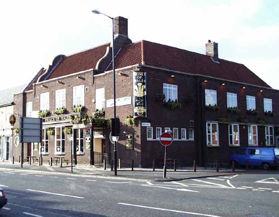
This is my local, the Prince of Wales. Its original late 1930s construction contains references to Dutch and north German styles. It has
recently been remodelled and now serves a slightly changed clientele. The students and locals rub shoulders still, but the desultory drugs pedlars are gone. The 1920s Tyneside flats host part of the teeming student
population. Fenham is a mixed and highly lively collection of people. There is a large immigrant population, and the two main schools in the area, Sacred Heart and Dame Allan's attract scholars from other areas.
|
|
|
|
|
|
This westward looking view of West Road shows the shopping area. Fenham is to the right, and Benwell is to the left.
The small domed tower in the centre of the picture is the Plaza building, originally a cinema, then a Bingo hall, but now a large bistro on its commanding corner site. |
|
|
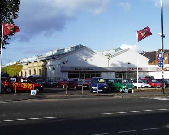
Below is the premises of Reg Vardy car sales. The building is the old tram sheds for the former Corporation
Tramways. There was a central generator at Manors in the city centre (electricity was novel at the time), and this was the depôt for the west of the city, the eastern shed was at Byker. |
|
|
|
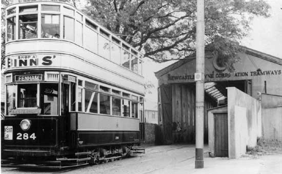
Here is the tram shed in action during 1937. The new fangled trolleybus was begining to replace the trams at this time, and it was not
long before this scene became a thing of the past. The last trams ran in 1950. Photo is a possesion of Newcastle City Libraries. |
|
|
|
|
|
The Tram sheds are situated at the southern end of Wingrove Road with its junction of West Road. This is the other end at its
junction with Fenham Hall Drive, so called because of a long gone great house.The 1905 pedigree of the buildings is evident. |
|
|
The church of St. James and St. Basil was built by Sir James Knott, a wealthy Newcastle shipowner, in
memory of his two sons, James and Basil, who were both killed in the First World War.
A note to me from Richard Carr, curate at the church during the 1950s, read; "I lived in Fenham and for a
time was curate at St James & St Basil.
"At that time, 35 years after the church was built, Sir James Knott still had a reputation for having been a hard man and an employer not noted as
demonstrating much of the milk of human kindness. The church was therefore sometimes referred to as 'Jimmy Knott's fire escape'.
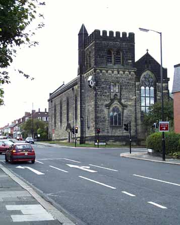
It has an industrial and utilitarian look. That corner clock has more
in common with a shopping arcade than a church! |
|
|
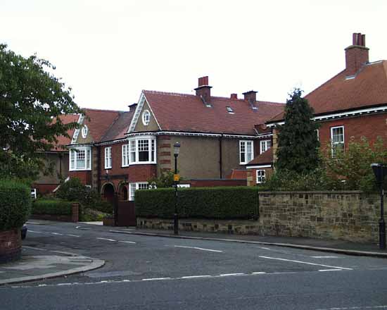
Below, the housing along Moorside North shows 1930s Art Nouveau tendencies mingling with traditional British cottage
architecture. These houses are for wealthy and professional people. |
|
 |
 |
|
|
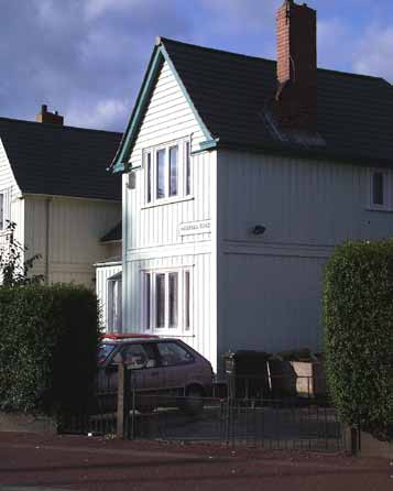
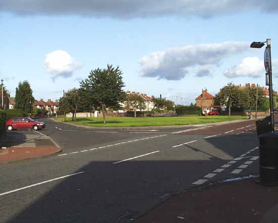
Hadrian Road runs through Fenham, here is the "Village Green" at the heart of the district. Below are two views of an experiment in house
construction. These wooden houses were erected in the 1920s and survive in good order today. They gave the idea for nearby Cedar Road, containing more of these houses as well as some prefabricated housing. |
|
|
Below is the swimming pool, adjacent to the branch library. This is a popular resource. Many are the lengths I have pounded
in this one. |
|
|
|
|
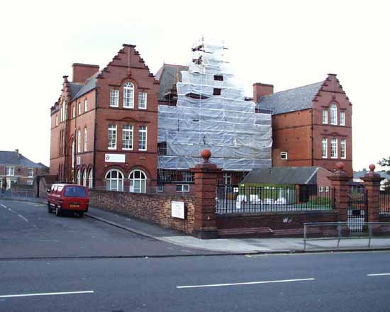
At the junction of West Road and Wingrove Road near the General Hospital, West Road becomes Westgate Road. Below is Westgate Primary
School. The building looks late Victorian. You can imagine the boys on the left and the girls on the right. |
|
|
|
|
|
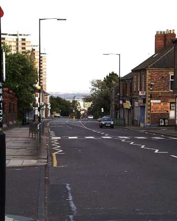
From the same place looking east towards the city centre Arthur's Hill dips down. On the left are three Swedish modular tower
blocks erected in the early 1960s during T. Dan Smith's regeneration of the city. He was alleged to have taken gifts in exchange for the contract to design and build these and about fifteen similar blocks in
the city.It has been said that he replaced horizontal slums by slums in the sky, but these blocks have been vastly improved recently and provide much needed single people's and small family accommodation.
|
|
|
|
|
|
 |
|
If you should arrive here via a search, or be missing the navigation on the left hand side, click this button.
|
|