|
Cruddas Pk
Sun. 19th Nov., 2000
|
 |
|
|
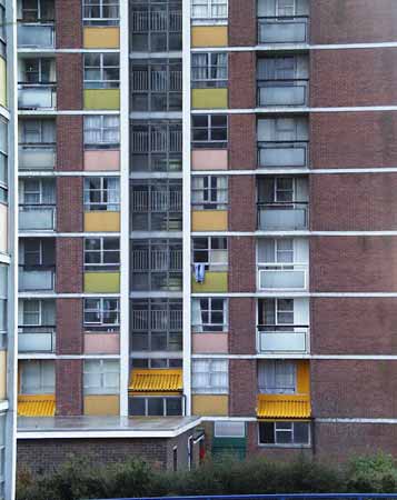
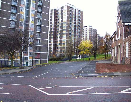
This 1960s housing estate, comprising mainly of tower blocks, replaced a small park and some terraced housing previously on
this site.It was named after George Cruddas who was a Director of the Armstrong armament works that lined the nearby northern bank of the Tyne. He lived in Dene House, now the site of Woolsingham Street
flats. The scheme was part of T. Dan Smith's grand plan for the city. The flats were built by Wimpey to a Swedish modular design. It was later to be alleged that Dan Smith took cash and other benefits for
awarding the contracts. |
|
|
|
 |
|
|
|
Photograph copyright A. Desmond Walton and West Newcastle Local Studies |
|
|
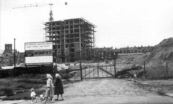
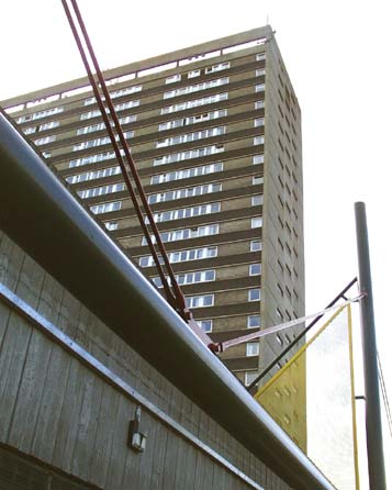
In 1961 work was just starting on the first block, later to be called the Hawthorns. This little street is called DeGrey Street, after
the Minister of War during the Crimean War. The streets in this area were named after Armstrong's
contemporaries in politics and engineering. He was a national figure when the government of the day accepted his field gun, manufactured here, for use during the Crimean War. Below is DeGrey Street today. |
|
 |
|
|
|
|
|
Here, at the foot of Clumber Street with its junction with Scotswood Road, the Gladstone Hotel stood. In 1854 the Duke
of Newcastle was Minister of War, and his grand residence was in Clumber Park, Nottinghamshire.Gladstone was the Victorian Liberal
Prime Minister from 1868 to 1885 with a gap from 1874 to 1880 when Tory Disralei was in
power.Nine of the new block of flats are like the two in this view, the tenth, seen here in the middle, surmounts the shopping centre and is of an entirely different and more substantial design.
|
|
|
This is the top of Clumber Street with the Roman Catholic St. Michael's church. The adjoining vestry market the top of the
terraced row that stretched down to Scotswood Road. The vestige of the gable end of the terrace is all that now remains.This late Victorian church architecture features a hexagonal tower. Other examples
have octagonal towers. |
|
|
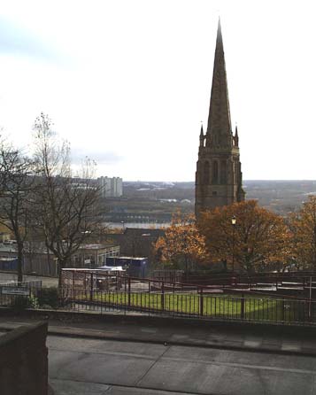
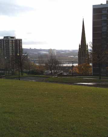
Clumber street now comes to a inglorious halt at the fence now surrounding St. Michael's RC School. The spire of St.
Stephen's, the Parish church for the district, can be seen beyond.The main body of this church was demolished during 1990 following a disastrous fire, the result of arson. Its place was taken by a nursing
home. The church hall was some distance away in Tulloch Street. |
|
|
A closer view of St. Stephen's from Brunel Terrace, the western boundary of Cruddas Park. This street was named after
Isombard Kingdom Brunel, famous engineer and builder of The Great Eastern Atlantic cable laying ship, and founder of the Great Western Railway with its quirky, yet luxuriant 8 foot gauge.Brunel's son,
later to pioneer the tunnelling under London for the first underground railway, was an apprentice at Armstrong's works in 1863. |
|
|
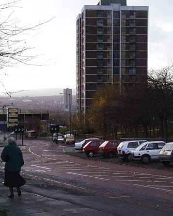
From nearby Haughton Court the two blocks visible here are, on the left The Willows, and on the right King's Meadow.
Haughton Court was named after George Cruddas' country home, Haughton Castle, Humshaugh, Northumberland. Whilst the names chosen in 1960 for the new blocks were neutral (names of trees and bushes) the one
exception was King's Meadow. The river, visible in this view, used to contain a small island at the spot we can see here. It was removed by Armstrong to aid navigation for his warships and big guns. This
island was called King's Meadow. |
|
|
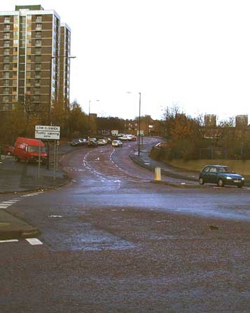
Here is the eastern edge of Cruddas Park, technically still Low Elswick. Today this is called Park Road, but Park Road is the
street above the wiggle. Park Road was a straight road and emerged on Scotswood Road some distance to the right of this shot. The junction here is the site of the original Tulloch Street that ran parallel
with Park Road.This area has undergone a second renaissance, after some justly deserved years in the cultural wilderness thanks to riotous and out of control crime, and a decade of hosting the Northern
Capital for the National Academy of Burglary Arson Stealing and Housebreaking (BASH). |
|
 |
|
Photograph copyright A. Desmond Walton and West Newcastle Local Studies |
|
|
|
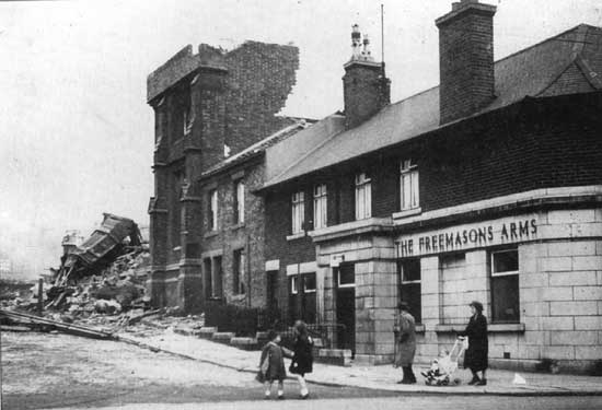
Here in October, 1960, is the same junction. The Freemason's Arms stood at the foot of Tulloch Street, adjacent to St. Stephen's Church
Hall. In a burst of optimism for the future, the terraces were pulled down. The church hall took a bit more determination! |
|
|
|
|
|
From the southern end of what remains of the original Park Road, The Pines is visible here.On the opposite side of the
river, in Dunston, Derwent Tower is clearly visible. This block was built in the 1970s and quickly gained the epithet "The Dunston Rocket". Scotswood Road runs from left to right, just at the edge of the
flood plain of the river. That narrow ribbon was the site for Armstrong's factory and other associated workshops. The main east west rail line to Carlisle used to run along here too. This changed in 1985
when a river bridge at Scotswood became too weak and the rail traffic was diverted across the river at Newcastle and along the Gateshead southern riverside. |
|
 |
|
|
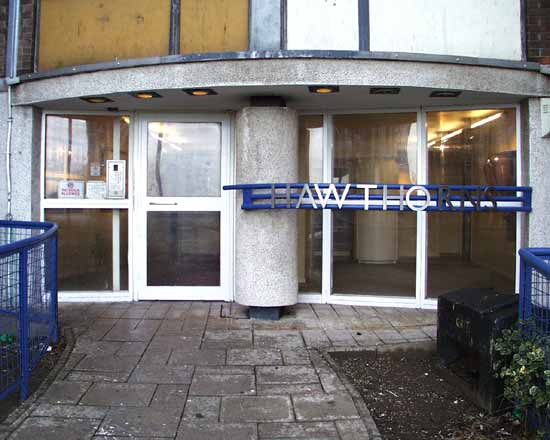
During the late 1980s the bold decision was made to revitalise the area and by a spectacular determination of local Council policy and
legal evictions, the criminal fraternity was smashed. New entrances were added to the flats with entry systems and a concierge. People living here were given a stake in the area in an attempt to encourage a pride and
care for the local environment. This 1930s style entrance is only one aspect of the mighty effort that went into rescuing the estate from annihilation from within. |
|
|
|
|
|
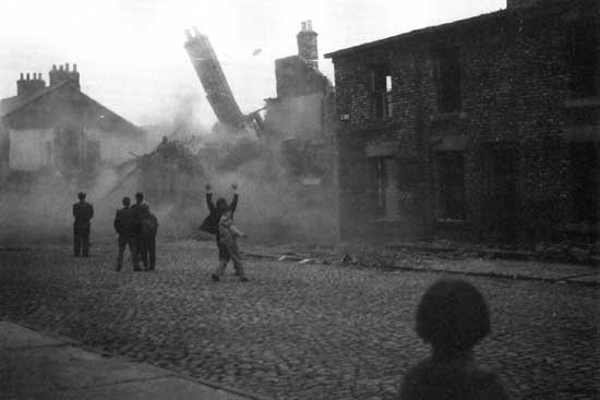
Here, opposite the Shopping Centre on Westmorland Road, 1970s flats, used by students and workers from the nearby College of
Arts, receives the attention of the dozer. This was low cost and highly unpopular housing. the local authority sees the way forward in clearing the site and trying again, rather than in trying to tinker with
the inevitable.Below, an earlier "slum clearance" in 1960 is greeted with cheers from the local lads. It is clear that Newcastle is a city with life in its veins. If renewal were to stop the place would
die. No one wants to live in a safely fossilised museum. Renewal must take place, but please, not at the expense of the local heritage. |
|
 |
|
Photograph copyright Jimmy Forsyth |
|
|
 |
|
|
|
|
The shopping centre has been given an overhaul. It now bristles security shutters, residents' computer operated key entry
systems, video cameras, and security patrols.The residential block above the shops is different from the rest and seems to have posed less problems in the past. I am not sure that this is the effect of
the building on the peole, or the people on each other. It is arguably the former as the folk who live here feel more of a community, and this has to be the action of the architecture. |
|
|
|
|
|
 |
|
If you should arrive here via a search, or be missing the navigation on the left hand side, click this button.
|
|